TL;DR: Dien Bien Province became Vietnam's first low-altitude economy pilot on June 23, 2026, authorizing 6,000 UAV flights across agriculture, healthcare delivery, goods logistics, and terrain mapping. The low-altitude economy sandbox gives Vietnam Post and partner operators a controlled environment to test drone operations before national rollout.

What Did Dien Bien Province Approve to Launch the Low-Altitude Economy Pilot?
On June 23, 2026, the Dien Bien Provincial People's Committee (UBND tỉnh Điện Biên) issued a controlled sandbox license for UAV-based digital technology products and services to support low-altitude economic development. This makes Dien Bien the first province in Vietnam to formally authorize this type of pilot under the national digital transformation framework.
The decision follows months of preparation between the provincial government, Vietnam Post (Tổng công ty Bưu điện Việt Nam), FPT Group (Tập đoàn FPT), and UAV manufacturers. The provincial Department of Science and Technology (Sở KH&CN) is the lead coordinating body, working with other provincial departments, operators, and local organizations to implement, guide, and monitor the program.
What Are the Four Sectors Covered by the Dien Bien UAV Sandbox?
The pilot is structured around four practical use cases that address Dien Bien's specific geographic and economic characteristics as a mountainous, remote province.
Agriculture: Test sites include a tea cultivation zone in Sinh Phình village, a coffee-growing area in Muong Ang district, macadamia orchards in Tuan Giao, and rice paddies in Thanh Nua. UAVs will support crop seeding, pesticide spraying, fertilizer application, crop health monitoring, and pest detection. These applications are particularly relevant in areas where terrain makes ground-based equipment impractical.
Healthcare logistics: The pilot will establish a UAV delivery network connecting Muong Ang District Health Center to commune-level health stations, including Nà Tấu commune and stations in Muong Dang, Ngoi Cay, and Ang To. The network is designed to transport medicines, medical supplies, and biological samples, improving healthcare access for remote communities.
Goods delivery: The logistics component covers general cargo transport, focusing on agricultural products, farming supplies, and essential goods. This is the most commercially scalable segment and the one most likely to attract private investment once the regulatory framework is proven.
Digital terrain mapping: UAVs will conduct geographic surveys, produce digital terrain models (DEM), and build out a spatial database that will serve the province's planning and development functions. This is one of the highest-data-intensity applications in the program and will generate the foundational geospatial layer for future drone operations across the province.
What Are the Program Targets?
Dien Bien has set a target of approximately 6,000 UAV flights during the sandbox period, which runs from the permit issue date through May 31, 2027. The province has committed to a safety target of more than 99 percent of flights conducted without incident.
Flight permits will initially be issued on a monthly cycle to allow the program to evaluate results and adjust before expanding the scope. All UAV operations during the sandbox period must be registered, reviewed, and approved in advance, with full compliance required across national defense and security requirements, airspace management rules, radio frequency regulations, and information security standards.
Who Is Running the Program?
Vietnam Post holds the lead operator role and is responsible for organizing and managing the flight operations. FPT Group and other UAV manufacturers are handling the technical side: UAV equipment, flight control software, and systems integration. Maintenance and support services are provided by specialist UAV companies. Local cooperatives, businesses, and residents in Dien Bien are included as end users and co-evaluators, which means the program is designed to test real-world adoption, not just technical performance.
Why Does This Matter for Vietnam's Data Infrastructure?
The Dien Bien pilot is not just a logistics experiment. It is generating three distinct categories of data that will be essential to scale UAV operations across Vietnam: a flight management database covering every authorized drone route, a digital terrain model built from actual survey flights, and operational performance data including safety rates, payload capacity, and route efficiency.
This data needs a geospatial and address intelligence foundation to be useful. Every drone delivery route must resolve to a precise location. Every healthcare drop-off point requires a verified address. Every agricultural zone needs accurate boundary data to coordinate multi-drone operations without airspace conflict. These are exactly the problems that DataCore's Geospatial Service and Address Service are designed to solve.
As Vietnam's low-altitude economy expands from Dien Bien to other provinces, the demand for precise geospatial data and address intelligence will grow sharply. See also our coverage on supply chain data security and Vietnam's national IT mission framework - both are shaping how data infrastructure gets built in 2026.
What Is Vietnam's Low-Altitude Economy and How Big Could It Get?
Vietnam's "low-altitude economy" (kinh tế tầm thấp) refers to the set of commercial activities conducted in airspace below a few hundred meters: drone delivery, agricultural UAV services, aerial photography, terrain survey, and eventually air taxi and cargo services. The concept was adopted from China's playbook and is being developed under Vietnam's Resolution 57 digital transformation agenda.
Analysts have projected that Vietnam's low-altitude economy could generate significant economic activity as drone delivery, aerial mapping, and precision agriculture scale nationally. China's low-altitude economy reached over 500 billion yuan in 2023, and Vietnam is working from a similar playbook of pilot provinces followed by national licensing frameworks.
Frequently Asked Questions
Why was Dien Bien chosen as the first province for the UAV pilot?
Dien Bien's mountainous terrain and remote communities make it a strong test case for UAV use cases that are economically justified specifically because ground transport is difficult and expensive. Agricultural UAV services, healthcare delivery, and terrain mapping all solve real problems that are hard to address otherwise in a province like Dien Bien.
What is a sandbox license in this context?
A controlled sandbox (thử nghiệm có kiểm soát) license allows companies to test regulated products and services in a real-world environment under close supervision. It provides legal cover for operations that are not yet fully licensed under standard regulations, while the regulator collects the data needed to write those regulations. Vietnam's sandbox model follows frameworks used in fintech regulation and is now being extended to UAV operations.
How does the UAV program relate to Vietnam's digital transformation agenda?
The program sits directly under Resolution 57, which tasks provincial authorities with identifying and executing digital transformation projects suited to their specific strengths. Dien Bien's application of UAV technology to agriculture and healthcare is the kind of locally-adapted implementation that Resolution 57 is designed to produce.
What geospatial data will the program generate?
The terrain-mapping component will produce digital elevation models (DEM) and flight-path databases for the areas surveyed. This data will feed into provincial planning systems and will serve as the foundation for future expansion of the UAV network. High-accuracy address and parcel-level data is needed as an input to make delivery routing and healthcare logistics work reliably across the province.
Low-Altitude Economy: The Global Context Behind Vietnam's UAV Pilot
Dien Bien's UAV pilot is part of a global wave of low-altitude economy policy development that began accelerating in 2023. China formalized the term "low-altitude economy" (低空经济) in its 2024 Government Work Report, treating it as a strategic growth sector alongside artificial intelligence and biotechnology. The National Development and Reform Commission estimated China's low-altitude economy reached CNY 506 billion (approximately USD 70 billion) in 2023 and projected it would exceed CNY 1.5 trillion (approximately USD 207 billion) by 2035.
The United States Federal Aviation Administration's BEYOND program has been running UAV integration pilots since 2019, and the FAA's 2024 Reauthorization Act included new authority for automated UAV flight corridors in rural and remote areas, precisely the operating environment that Dien Bien represents. The European Union Aviation Safety Agency (EASA) published its U-Space regulation in 2021, creating a framework for low-altitude economy operations that has been adopted across all 27 EU member states.
Vietnam is arriving at low-altitude economy policy roughly three to four years behind China's explicit framework but ahead of most other ASEAN countries. Indonesia, Thailand, and Malaysia are still in the study phase for drone corridor regulation. Vietnam's Dien Bien pilot, backed by a formal provincial government approval and a defined 6,000-flight sandbox, is more operationally advanced than most regional peers. That positioning advantage is meaningful: low-altitude economy infrastructure tends to create network effects, and early movers accumulate operational data and regulatory experience that later entrants must pay to catch up with.
Technical Requirements for a Low-Altitude Economy UAV Corridor
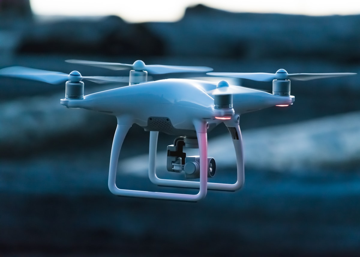
Operating a low-altitude economy at the scale of Dien Bien's 6,000-flight sandbox requires a layered technical infrastructure that most observers underestimate. The visible layer is the UAV itself: the aircraft, its payload (camera, sensor, delivery compartment, or survey instrument), and its ground control station. But the invisible infrastructure is what determines whether a low-altitude economy scales beyond a demonstration project.
Flight management systems must track every UAV in the corridor in real time, enforce altitude separation between different mission types, and dynamically reroute flights when weather, military activity, or conflicting civilian airspace use creates hazards. Dien Bien's terrain, which includes significant mountain ranges and valley fog, makes this technical challenge harder than flat-terrain pilots in the Mekong Delta would face. The UAV systems selected for the sandbox must have robust terrain-following capabilities and weather avoidance systems certified for mountain operations.
Communication infrastructure presents a second major technical requirement. UAVs operating beyond visual line of sight (BVLOS), which is required for agriculture and logistics applications across Dien Bien's dispersed farming communities, need reliable low-latency connectivity throughout the flight corridor. In Dien Bien, terrestrial 4G coverage is uneven in remote valleys. The pilot will need to evaluate whether satellite connectivity (likely from LEO constellation providers) can supplement terrestrial networks to provide the BVLOS communication reliability that a functioning low-altitude economy requires.
The digital terrain model (DEM) component of the sandbox is specifically designed to address this technical gap. By mapping Dien Bien's terrain with centimeter-level precision, the DEM enables flight management systems to predict communication dead zones, calculate optimal flight corridors for each mission type, and generate the obstacle databases that UAV autopilot systems use for terrain avoidance. This data infrastructure investment is what transforms a 6,000-flight demonstration into a replicable low-altitude economy platform.
Economic Projections: How a Low-Altitude Economy Could Change Dien Bien's Development Trajectory
Dien Bien Province had a gross regional domestic product (GRDP) of approximately VND 8.7 trillion (USD 345 million) in 2024, making it one of Vietnam's smaller provincial economies. The province's growth has been constrained by its remote location and limited road infrastructure connecting its farming communities to markets. A functioning low-altitude economy directly addresses this geographic constraint by moving goods and services through airspace rather than roads.
The agricultural component of the sandbox targets Dien Bien's dominant economic sector. Rice farming on the Muong Thanh plain, the province's agricultural heartland, could benefit immediately from UAV precision agriculture services: field health monitoring, targeted pesticide application (which reduces chemical input costs by an estimated 20 to 40% in comparable programs in China and Thailand), and yield mapping that improves crop planning accuracy. If the UAV agriculture component reaches 30% of Dien Bien's cultivated area within three years of the pilot, the productivity gains could contribute VND 200 to 400 billion annually to provincial agricultural output.
The medical logistics component addresses a critical quality-of-life gap. Dien Bien has 11 districts, several of which are accessible only by mountain roads that become impassable in the rainy season. UAV medical delivery enabling essential medicines, blood products, and diagnostic samples to reach these districts regardless of road conditions could reduce medical emergency response times from hours to minutes. The economic value of this capability is difficult to quantify directly but has clear public health and equity dimensions that strengthen the political case for sustained investment in the low-altitude economy program.
Frequently Asked Questions: Dien Bien UAV Low-Altitude Economy Pilot
What is the low-altitude economy and why is Dien Bien piloting it?
The low-altitude economy refers to commercial and public-sector activities that occur in airspace below 1,000 meters, primarily using UAVs (unmanned aerial vehicles, commonly called drones). Dien Bien was chosen as Vietnam's first provincial pilot because its remote geography, large agricultural area, and dispersed communities create ideal conditions to demonstrate the value of UAV services. The province's terrain also provides a technical challenge that, if solved, makes the resulting low-altitude economy framework applicable to other mountainous provinces across Vietnam.
How many flights are in Dien Bien's low-altitude economy sandbox?
Dien Bien's provincial government approved a sandbox of 6,000 flights over a two-year period, running from mid-2026 through mid-2028. The flights cover four mission types: agricultural monitoring and precision spraying, medical logistics delivery, cargo and postal delivery, and terrain survey for digital elevation model construction. Each mission type has its own approved flight corridor and altitude envelope within the broader low-altitude economy sandbox framework.
Can the Dien Bien low-altitude economy model be replicated in other Vietnamese provinces?
Yes, replication is an explicit design goal of the Dien Bien pilot. The Ministry of Science and Technology and the Civil Aviation Authority of Vietnam (CAAV) are using the 6,000-flight sandbox to develop a provincial low-altitude economy regulatory template that can be adapted for other provinces without requiring each one to start from scratch. The DEM data and flight management protocols developed in Dien Bien will be made available as a national asset for other provinces implementing their own low-altitude economy programs.
What role does data play in building a low-altitude economy?
Data infrastructure is the backbone of a functioning low-altitude economy. Flight management systems require real-time airspace data to safely separate UAVs. Agricultural UAV services depend on high-resolution crop health data to target interventions. Medical logistics UAVs need up-to-date facility location and inventory data to optimize routing. The terrain survey component of Dien Bien's sandbox generates digital elevation data that enables all other mission types to operate safely. Organizations like DataCore that aggregate and structure geospatial and organizational data in Vietnam are positioned to support the data layer of future low-altitude economy programs.
What Investors and Technology Providers Should Know About Vietnam's Low-Altitude Economy Market
Vietnam's Dien Bien low-altitude economy pilot is the first formal opening of a market that has been building informally for several years. Vietnamese agriculture cooperatives have been purchasing consumer-grade UAVs for spraying and monitoring since 2021. The Dien Bien sandbox formalizes this activity, creates a regulatory framework, and most importantly generates the performance data that commercial UAV operators need to build business cases for full-scale deployment.
For international UAV manufacturers and technology providers, the Dien Bien pilot is an entry point to a significant market. Vietnam has approximately 10 million hectares of agricultural land. Even a 10% market penetration for UAV precision agriculture services would represent a fleet of several thousand commercial aircraft and a recurring service market for sensors, software, and maintenance. DJI Agriculture, Wingtra, Yamaha Motor, and domestic Vietnamese UAV developers including Viettel Aerospace are all tracking the sandbox's outcome closely.
The Vietnamese Government's intent is that the Dien Bien low-altitude economy pilot produces a regulatory and operational blueprint that can be replicated at national scale within five years. For investors evaluating Vietnam's UAV market, the 6,000-flight sandbox is not the endpoint but the starting pistol. The companies and technologies that perform best in Dien Bien's challenging mountain terrain will have a strong competitive position when the low-altitude economy framework expands to Vietnam's flatter, more densely populated, and more commercially attractive provinces.